 vesseltracker.com
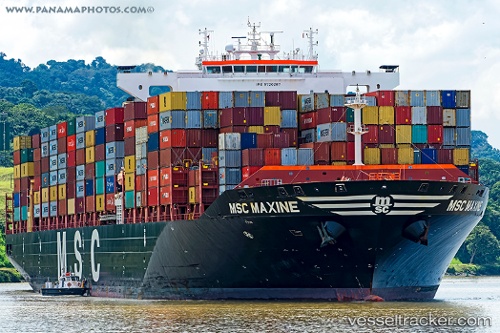
Vessel MSC MAXINE IMO: 9720287, MMSI: 255806521 Container Ship
UTC, -34.67665, 21.33293, course: 264, speed: 18.6
UTC, -34.94352, 20.46088, course: 242, speed: 18.2
2026-02-28 02:06:02 UTC, -35.03710, 19.76920, course: 285, speed: 18.3
Live AIS position:
UTC. 17 nm SW of Cape Agulhas),
updated 2026-02-28 02:06:02 UTC.
Find the position of the vessel MSC MAXINE on the map. The latter are known coordinates and path.
marine traffic ship tracker show on live map
The current position of vessel MSC MAXINE is -35.03710 lat / 19.76920 lng. Updated: 2026-02-28 02:06:02 UTCCurrently sailing under the flag of Portugal (MAR)
MSC MAXINE built in 2015 year
Deadweight:
110629 tDetails:
Last coordinates of the vessel:
UTC, -34.60904, 21.77705, course: 259, speed: 18.7UTC, -34.67665, 21.33293, course: 264, speed: 18.6
UTC, -34.94352, 20.46088, course: 242, speed: 18.2
2026-02-28 02:06:02 UTC, -35.03710, 19.76920, course: 285, speed: 18.3